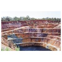
Corine Lan Cover layer and high resolution EU-DEM for Çelebi-Kesiköprü District in Turkey
Data and Resources
Dataset Info
These fields are compatible with DCAT, an RDF vocabulary designed to facilitate interoperability between data catalogs published on the Web.| Field | Value |
|---|---|
| Publisher | |
| Modified Date | 2018-05-01 |
| Release Date | 2018-03-20 |
| Identifier | 789a471b-161c-43f1-9a28-774966beaa10 |
| Spatial / Geographical Coverage Area | POLYGON ((33.137512207031 39.254446280442, 33.137512207031 39.71232813033, 33.686828613281 39.71232813033, 33.686828613281 39.254446280442)) |
| Spatial / Geographical Coverage Location | Çelebi-Kesiköprü District in Turkey |
| License | |
| Author | |
| Contact Name | Maria Przyłucka |
| Contact Email | |
| Public Access Level | Public |


![[Open Data]](https://assets.okfn.org/images/ok_buttons/od_80x15_blue.png)